Posts

Torr Ghabhscabhaig

Image
  Torr Gabhscabhaig with Loch Gabhscabhaig in the foreground The Hill: Torr Gabhscabhaig Location: Between Tarskavaig and Tokavaig, Sleat, Isle of Skye Grid Reference: NG592108 Height: 92m Classification: Tump The Walk Ascent: 30 metre Distance: 100 metres (round trip) Terrain: Steep climb on rough ground Parking: Space for a maximum of three cars in a wide passing place at the base of the hill. Sleat is one of the least hilly parts of Skye. It doesn't have anything even remotely resembling a mountain. It is therefore somewhat surprising that the road to this tiny tump is one of the few on the island which throughout my childhood bore signage proclaiming it "unsuitable for caravans". It hasn't been upgraded since, and there are many many bends and some ferociously steep hills. This makes it very popular with cyclists (who never have to reverse) but less so with drivers. It's one of my least favourite drives, and always takes about eight times longer to do than I e...

Smailholm Tower

Image
Lady Hill, Scottish Borders Smailholm Tower, photographed from part way up Lady Hill The Hill: Lady Hill Location: By Smailholm Tower, Sandyknowe Farm, Kelso, TD5 7PG Grid Reference: NT 63547 34522 Height: 207m Classification: Tump, Trig Point The Walk Ascent: 30 metre Distance: 1km (round trip) Terrain: Grassy sheep track type paths Parking: Smailholm Tower Carpark or nearby verges Smailholm Tower dominates the landscape for so many miles around that it is a little surprising that it isn't actually on the highest point in the area. The summit of the tump is a little beyond the tower and marked with a trig point. Of course you would be higher up if you visited the tower and climbed to the top, sadly however it was closed when we visited, and at the time of writing remains closed. However, I have it on good authority (the word of an aunt no less) that it is worth a visit, so we will attempt a return trip once it reopens.  Another downside of the tower being closed was that the carp...

Soutra Hill

Image
Location: Soutra Hill, Scottish Borders Grid Reference: NT 4593 5908 Height: 377m Classification: Tump Like every other person with a chronic illness, my health is variable. On a good day I can manage a whole mile (occasionally even two), other days I can barely manage 20 or 30 metres. It's on the latter type of day that the drive-by tump really comes into it's own. These are hills with roads running to, or near the summit. Sometimes this will be intentional - there might be a tourist route up to a viewpoint - but sometimes it's just circumstantial.  Soutra Hill comes somewhere between the two. It's on the route of a historic road from Edinburgh to the borders, and while the modern A68 skirts to the east and the A7 to the west of the summit, the B6368 to Gilston runs over the top of the hill. The true summit is to the south of Soutra Mains Wood in a large farmers field, about 50 metres from the road.  The hillbagger and I on the true summit of Soutra Hill When we visite...

Queens Park

Image
The Hill - Camp Hill View from the summit, Camp Hill in Queen's Park (photo included with kind permission from the big boy cousin) Location:  Queen's Park, Glasgow Grid Reference: NS57912 62080 Height: 64 metres Classification: Tump The Walk: Many Routes Available Distance: 600m to 1.2km Climb: 20m  to 40m Terrain: choice of smooth tarred paths or rough woodland paths Parking: free on-street parking in side streets around park (availability - hit or miss) Public Transport Various busses stop around the park (check online for up to date info) Queen's Park Train Station is 0.1 mile from the park.  Mount Florida, Crossmyloof and Pollockshields West Train Stations are 0.4 miles from the park.  Maps I normally draw these, but due to the complexity of the park I put this off for literally months after I finished writing this blog post. In this interests of actually getting it published I am abandoning the drawing plan and giving links instead. It is a city park and has exc...

Three Lochs Forest Drive View Point

Image
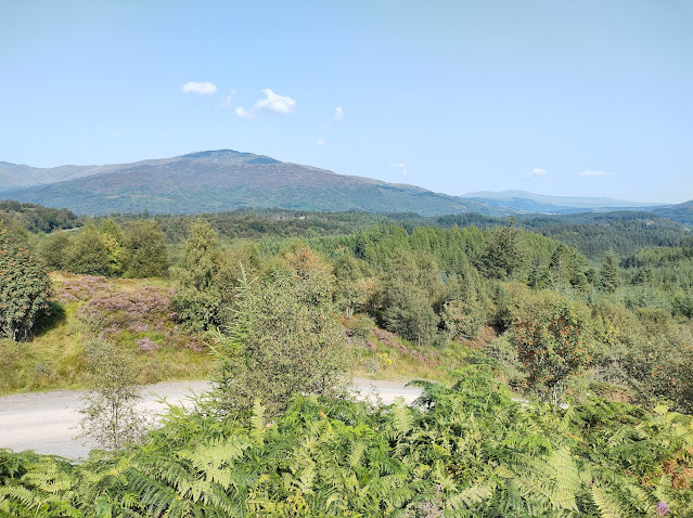
Three Lochs Forest Drive Viewpoint View The Hill - Three Lochs Forest Drive View Point  Location: First Carpark, Three Lochs Forest Drive, North of Aberfoyle Grid Reference: NN52140 The Walk Ascent: 3m Distance 100m each way  Terrain - good path, suitable for a wheelchair Parking - plentiful in the carpark Despite being too small to be classified on any hillbaggers ticklist this hill was too delightful not to blog about. I climbed it in late August, and it was an absolute feast for the senses. The views were stunning, the birds were singing, and the minute you left the car you were bathed in the honey sweet scent of heather.  Interpretation panel with map showing the Forest Drive.  You are here  in top left marks the carpark for the viewpoint.  Note: Map is upside down, the hillbagger found this quite disturbing. The viewpoint is at the very start of the Three Lochs Forest Drive near Aberfoyle, which should get a commendation for accessibility. It's a loop...

Ramasaig Cliffs

Image
Summit at Ramasaig Cliffs with Neist Point behind, featuring me and a dog on a string The Hill - Ramasaig Cliffs Location: Waternish Peninsula, Isle of Skye Grid Reference: NG158449 Height: 248m Classification: Tump The Walk Ascent: 30m Distance: 1km there and back (0.6 miles) Terrain: Firm ground with well grazed grass. No path. Parking: Tucked well in to the side of a passing place at the high point on the road to Ramasaig.  This short walk gives you an excellent view out over the cliffs at Ramasaig to the much more famous Neist Point. It's another route with interesting driving single track driving - you take the B884 all the way up through Glendale, along with all the tourists heading for Neist Point.  I would highly recommend stopping en route at the  Glendale General Store  in Lephin. It's a delightful old-fashioned local shop, selling everything from potatoes to playing cards. The entire shop is smaller than my living room and it is quite amazing what they man...