Sgurr a' Chaorachain, Beallach na Ba
The Hill - Sgur a' Chaorachain North Top
View From Sgur a' Chaorachain North Top towards the South Top, North Shiel Ridge and Kintail in background.
Location: Applecross Peninsula, Scottish Highlands
Grid Reference: NG 78578 42403
Height: 773m
Classification: Corbett Top, Tump
Grid Reference: NG 78578 42403
Height: 773m
Classification: Corbett Top, Tump
The Walk
Ascent: 150m
Distance: 2.5km there and back (1.5 miles)
Terrain: Rough track to radio mast then a few metres on rocky ground.
Parking: Bealach na Ba view point [NG 7738 42635]
Distance: 2.5km there and back (1.5 miles)
Terrain: Rough track to radio mast then a few metres on rocky ground.
Parking: Bealach na Ba view point [NG 7738 42635]
 |
| Bealach na Ba and Sgur a' Chaorachain Map |
So, for all the misanthropes out there, I highly recommend venturing up to the North Top of Sgur a' Chaorachain. This was the very first hill I climbed with the hill bagger, so it has a special place in my heart. But it also gives you a beautiful view inland which you won't see from the viewpoint. From the car park simply follow the road a short distance uphill to the track leading to the radio mast.
 |
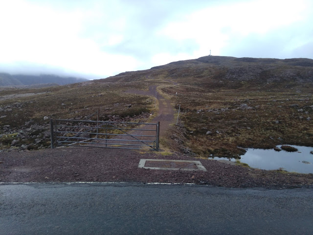
| Gate to the path up Sgur a' Chaorachain |
The gate is locked to keep cars out, but as there is no fence it is easy to circumnavigate. The path leads almost all the way to the summit, and I am confident that if you manage the track you will manage the last couple of metres over rocky ground to the summit. The car park was heaving the day that we visited, but we were the only ones on the path. I particularly enjoyed looking down on the steady stream of matchbox sized cars beetling along below me.
 |
| The Hill Bagger admiring the view of the Trotternish Ridge from the track. |
Be aware that although the walk is fairly short, and the climb from the road is only 150m, you are very high up by the time you reach the summit. So it will probably be cold and almost definitely will be windy. The hill-bagger wasn't used to quite how slowly I walked at this stage and was very glad that I had a spare hat in my jacket pocket! We abandoned plans for a picnic at the summit and continued down to Applecross where the weather was significantly more clement.


Comments
Post a Comment